
Ukrainian drone found crashed near Parcheș, Tulcea, Romania
A Russian Geran/Shahed strike drone crashed near Parcheș, Tulcea County, Romania at 00:44 local on March 26, 2026, after crossing 4 km into Romanian territory. No casualties or damage were recorded.
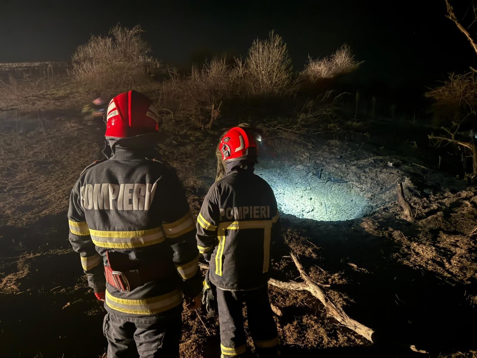
At 00:44 local EEST (22:44 UTC on March 25, 2026), a Russian Geran/Shahed strike drone crashed in an uninhabited area approximately 2 km from the village of Parcheș in northern Tulcea County, southeastern Romania. The drone had penetrated roughly 4 km into Romanian territory after crossing the border from Ukraine. No casualties were reported and no infrastructure was damaged.
AirVeto's wind-model data for the event window: At 22:00 UTC on 25 March - at the start of the approach window - the 1,000 m layer over northern Tulcea County showed NE wind at 5.6 km/h.
How Romanian forces responded before the crash
Romanian Air Force Base 86 "Locotenent aviator Gheorghe Mociorniță" at Borcea/Fetești scrambled two F-16 Fighting Falcons at 00:16 local EEST (22:16 UTC on 25 March), 28 minutes before the drone came down. The aircraft were airborne and tracking the contact when the drone crashed on its own at 00:44. RO-Alert cell-broadcast warnings were issued to residents in northern Tulcea County at 00:35 local EEST, nine minutes before the crash. MApN (Ministerul Apărării Naționale) and SRI (Serviciul Român de Informații) both dispatched specialist teams to the crash site to secure the area and begin technical examination of the wreckage.
Russia's strikes on Danube infrastructure and the border crossing
During the early hours of March 26, 2026, Russia launched an overnight wave of drone strikes against Ukrainian civilian and energy infrastructure near the Danube, targeting the border zone in northern Tulcea County. Parcheș sits in the northernmost part of Tulcea County, within a few kilometers of the Ukrainian frontier. Ukrainian air defenses engaged the incoming drones over Ukrainian territory; diverted or damaged drones that escape the engagement envelope lose guidance fidelity and can drift or fly unpiloted across the border into Romania before fuel or mechanical failure brings them down. The Parcheș drone penetrated approximately 4 km before crashing in uninhabited terrain.
Romania summoned the Russian ambassador
Following MApN's press release confirming that a drone of Russian origin had crashed on Romanian soil, Romania's Ministry of Foreign Affairs summoned the Russian Ambassador to Bucharest. The ministry described the incident as a direct consequence of Russia's irresponsible conduct in prosecuting its war against Ukraine across a boundary that puts NATO member territory at risk. MApN stated that the drone was a Geran/Shahed type and that forensic teams had secured the wreckage; the ministry underlined that Romania holds Russia responsible for every airspace violation originating from its drone operations.
Romania's growing incident record
The Parcheș crash was the second confirmed drone crash on Romanian soil in 2026. Debris from a Russian drone had been found on Romanian territory in January 2026; a February 2026 incursion near Sfântu Gheorghe in the Danube delta transited Romanian airspace and exited without crashing: see the Sfântu Gheorghe incursion, February 25, 2026. Romania's defence ministry later confirmed 7 airspace violations from January through April 2026 alone.
The series escalated in the months that followed. On April 25, 2026, a drone came down at Galați Bariera Traian, damaging a farm outbuilding and a power line: see the Galați Bariera Traian drone crash, April 25, 2026. The most severe incident in the sequence came on May 29, 2026, when a Geran-2 struck a 10-storey apartment block on Bulevardul Brăilei in Galați and injured two residents, the first Russian drone to wound civilians on NATO territory: see the Galați apartment block struck by Geran-2, May 29, 2026.
Wind conditions over northern Tulcea County
At 22:00 UTC on 25 March - at the start of the approach window - the 1,000 m layer over northern Tulcea County showed NE wind at 5.6 km/h. Near-calm conditions at altitude were the atmospheric background for the crossing and crash. See methodology for full detail on how wind data is used in AirVeto's incident pages.
AirVeto's account of this incident is sourced from reporting by Romania Insider, Militarnyi, and the Romanian Ministry of National Defence, and on wind-model data for the 22:44 UTC event window on March 25–26, 2026.
Methodology: see methodology. Page published 2026-06-03 by AirVeto.
Related location
- Romania - Romania, a NATO member since 2004, shares a Danube-river border with Ukraine at the Black Sea delta and has repeatedly recorded drone debris, intercepts, and naval-drone incidents along that frontier and its Black Sea coast since September 2025.
Sources
- GlobalSecurity.org / Romanian MND - Romanian MND statement on drone crash in Tulcea County (March 26, 2026)
- Romania Insider - Drone crashes in Romania as Russia launches attacks against Ukraine (March 2026)
- The Romania Journal - Drone crashes 2 km from Parcheș village in Tulcea County
- Spotmedia - A Russian drone crashed 2 km away from the town of Parcheș in Tulcea (photo/video)
- Militarnyi - Russian drone crashes in Romania during attack on Odesa region (March 26, 2026)
- Methodology
Last updated: