Press kit.
Brand assets and information for media, press, and partnerships.
About AirVeto
AirVeto is Europe's AI airspace analyst, built on the EU's eastern border from Finland to Romania. It shows the wind at 8 heights, live and 3 days ahead, alongside aircraft, satellites and official drone zones, and reconstructs every documented balloon and drone incursion with the wind that carried it. Users can add their own data sources, such as drone telemetry, radar networks and fleet GPS, and Companies users can have an AI assistant place sensors and plan interceptor sites on the map.
AirVeto launched in December 2025. It serves researchers, journalists, border security analysts, and the general public as a tool for understanding cross-border airflow patterns.
Key facts
- Launch date: December 2025. Incident archive reconstructed back to August 2025.
- Coverage: EU eastern border, from Finland to Romania. Incident archive across 16 countries.
- Languages: English, Lithuanian, Polish, Latvian, Estonian, Finnish, Romanian, Swedish, Norwegian
- Publisher: AirVeto
Logo & Icon
The AirVeto icon comes in two versions: light for dark backgrounds, ink for light backgrounds.




Brand Colors
#FF6200#1DB95C#0B1216#141F24#2A4148#F1F5F9Product
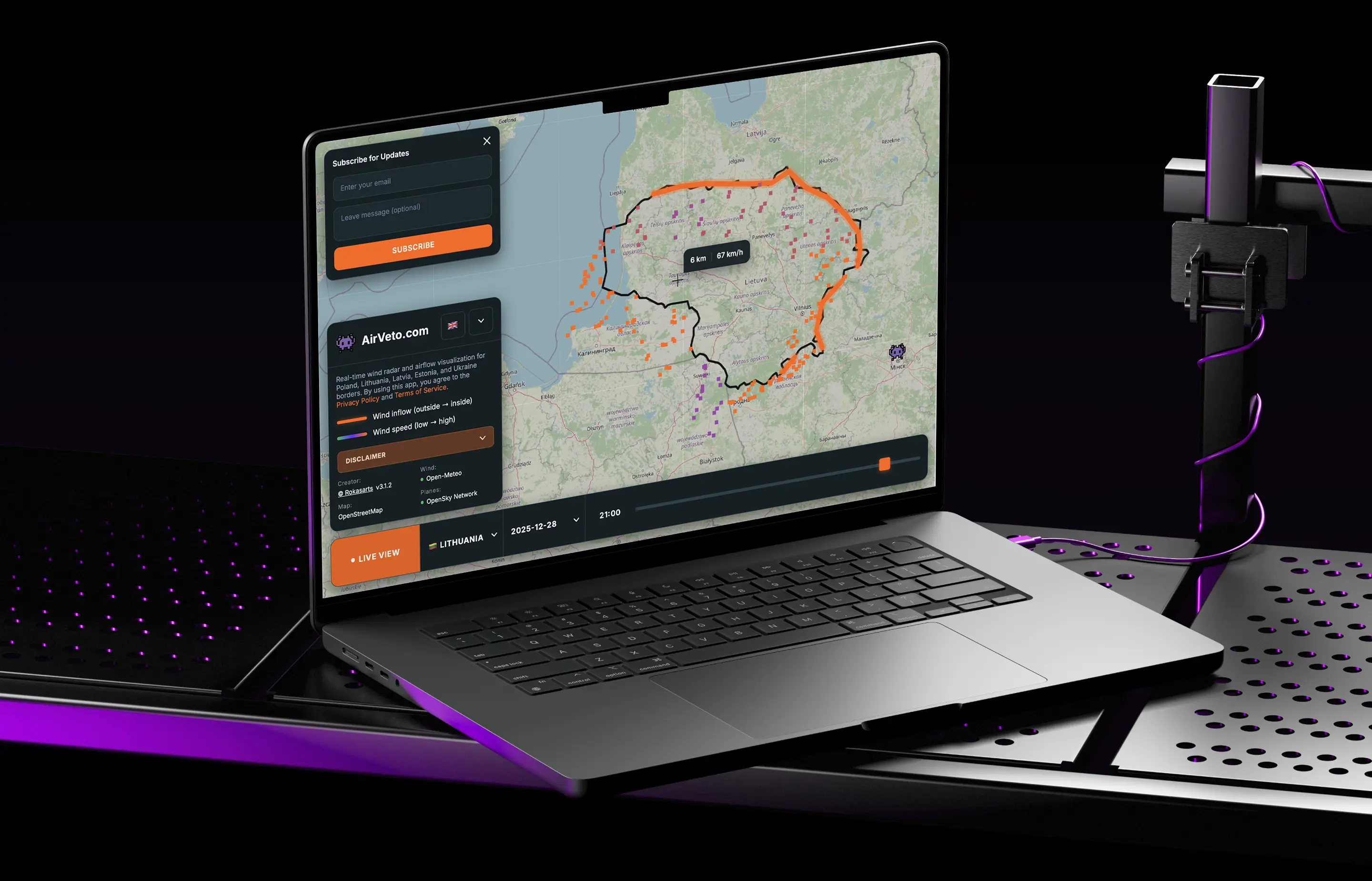
AirVeto wind map showing cross-border airflow and aircraft tracking.
Features
- Live wind visualization - hourly wind data at 8 altitudes along the EU's eastern border, from Finland to Romania
- Aircraft tracking - real-time flight positions, altitude, speed, and callsign data
- Satellite tracking - orbital positions via TLE/SGP4 propagation
- Wind forecasts - 3-day forecast at 8 heights, from 80 m to 7 km
- Incident archive - reconstructed wind drift behind airspace incidents since August 2025
- Custom API connectors - connect drone telemetry, radar networks, fleet GPS, or any HTTPS data source
Embed in your article
Any point in AirVeto’s coverage can be embedded as an interactive wind map in articles, blog posts, and OSINT analyses. The embed shows the wind field at the altitude and time you choose, the EU eastern frontier, and inflow highlights — the same visualization used on AirVeto’s own incident pages.
Embeds are free for journalism, research, and educational use. For commercial use beyond editorial reporting, contact us. The embed displays an AirVeto credit and link automatically; no additional attribution markup is required.
Usage Guidelines
- Use the AirVeto name and logo only to refer to the AirVeto product.
- Do not imply endorsement or partnership without written agreement.
- For product screenshots, use the live site at airveto.com.
Contact
For press inquiries, partnerships, or interview requests, email hello@airveto.com, use the contact page, or reach out on LinkedIn.
Design: Korys Studio.
See the wind live.
Real-time wind visualization and trajectory prediction - free account, no credit card required.