See where the wind takes it.
Live wind visualization for Eastern Europe. Predict the drift paths of smuggling balloons before they cross the border.
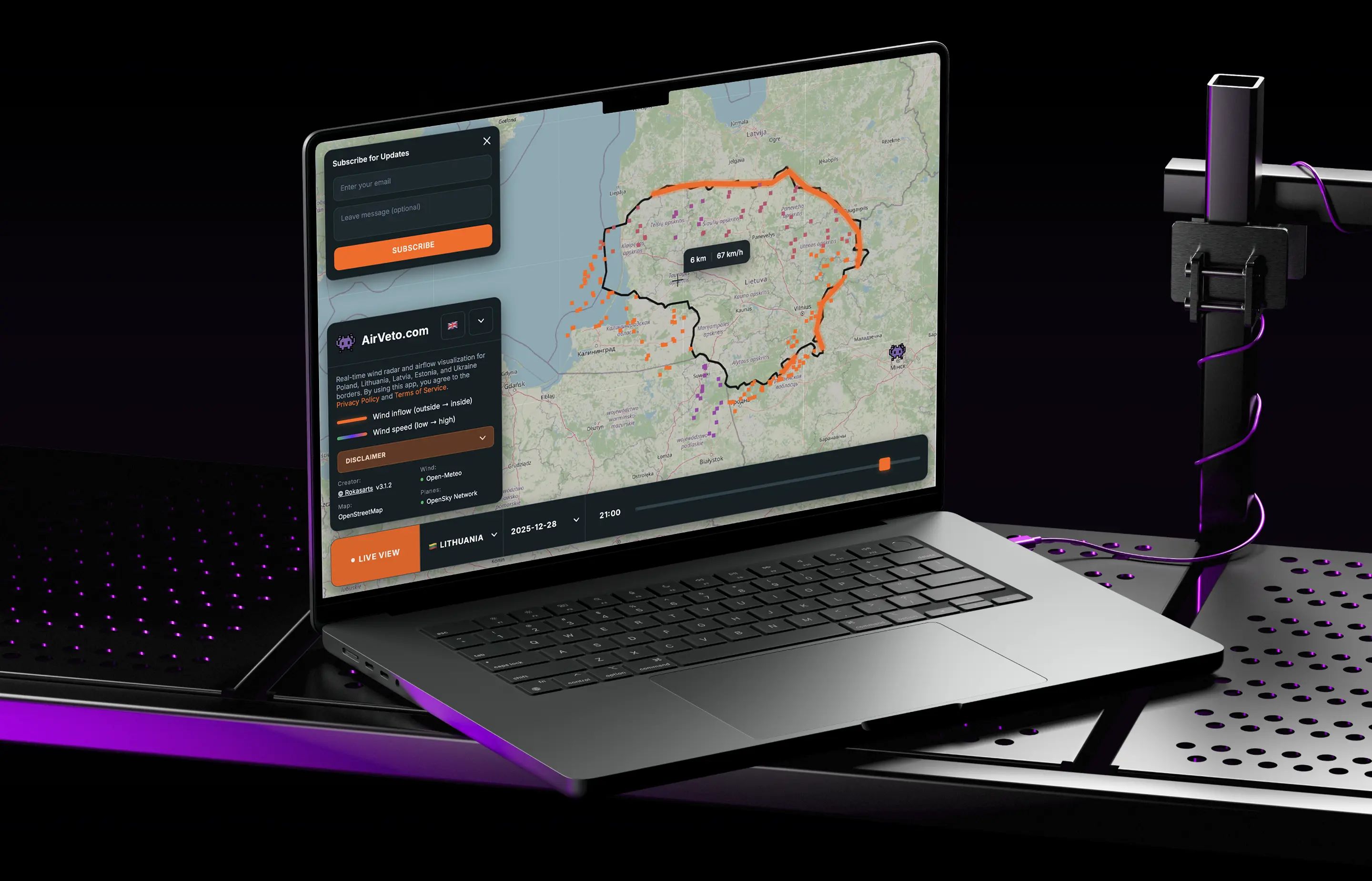
Tracking across five countries.
AirVeto covers Poland, Lithuania, Latvia, Estonia, and Ukraine — the EU's eastern frontier. Hourly wind vectors, near-real-time aircraft positions, Baltic Sea vessel tracking, and satellite orbits, rendered as a continuous field on a single map.
Built on public signals.
Wind comes from Open-Meteo, aircraft from the ADS-B receiver network, vessels from the Baltic AIS feed via Digitraffic, and satellites from public TLE data propagated locally with SGP4. Basemap by OpenFreeMap.
Connect your own sources.
Pro users can connect custom APIs to overlay their own data on the live map. Track drones, monitor radar detections, or follow fleet vehicles — all in real time.
Drone Telemetry
Track drone positions at altitude with live speed and heading data.
Radar Networks
Display radar stations and their detections with connection lines.
Fleet GPS
Monitor patrol units or research vehicles with real-time position updates.