
Dieveniškės Loop, 22 Jun 2026 - 3-meter fixed-wing from Belarus
Lithuanian border guards intercepted a 3-meter fixed-wing drone from Belarus near the Dieveniškės Loop, Šalčininkų district, on June 22, 2026, using counter-drone equipment.
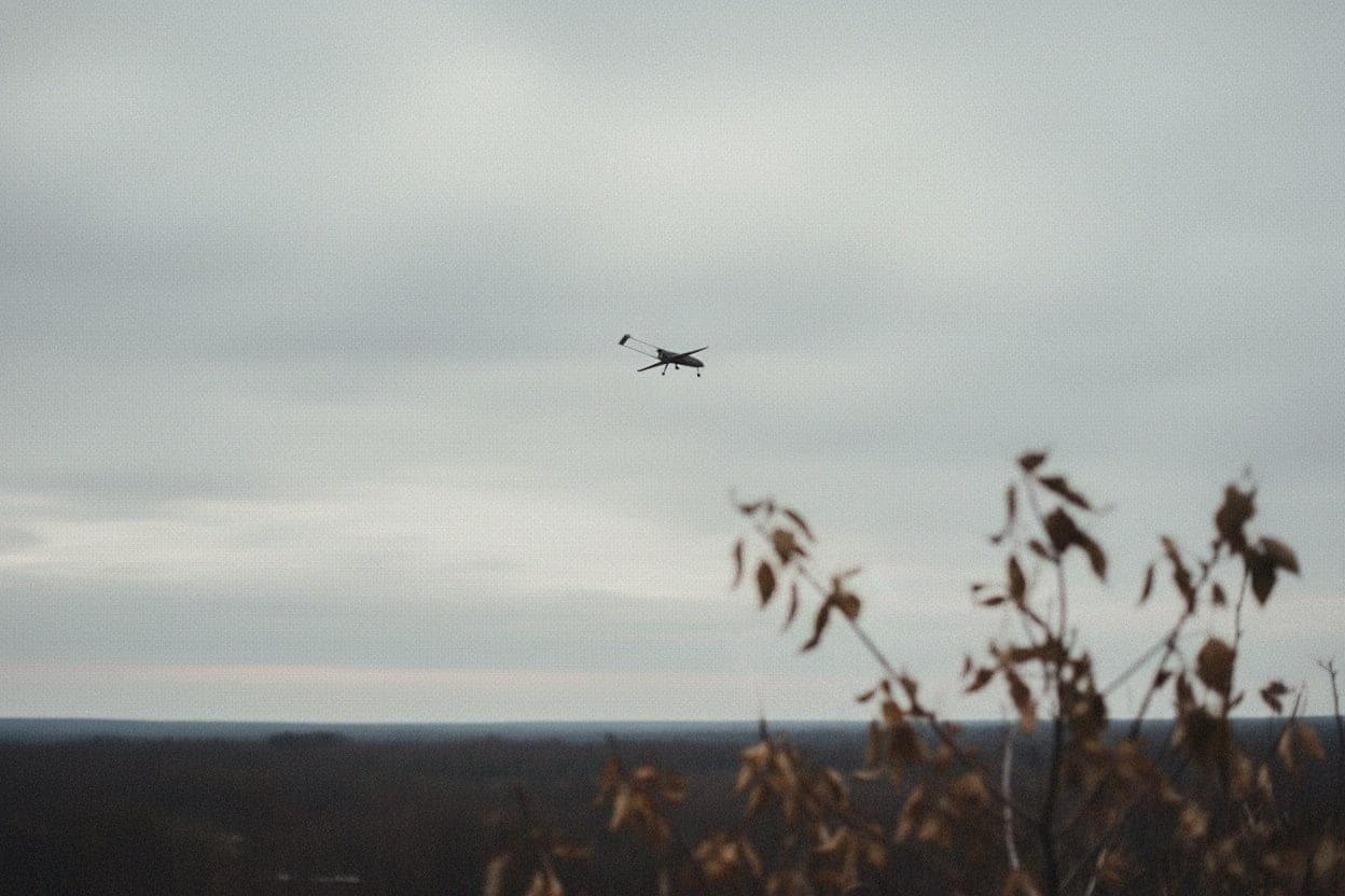
During the night of June 21–22, 2026, Lithuanian border guards brought down a fixed-wing drone from Belarus near the Dieveniškės Loop in Šalčininkų district, using counter-drone equipment. The aircraft had a wingspan of approximately 3 meters and contained a cargo compartment designed to carry and drop cigarettes. A deployed parachute recovery system was found at the crash site; no cargo was inside the compartment at the time of interception. The incident was reported by REFORM.news and attributed to Lithuanian State Border Guard Service (VSAT) operations. AirVeto's wind layer covers the Šalčininkų district and the southern Lithuania-Belarus border zone during the 22 June event window.
The Dieveniškės Loop is Lithuanian territory nearly enclosed by Belarus
The Dieveniškės Loop is a narrow peninsula of Lithuanian land in Šalčininkų district that projects east into Belarusian territory and is bounded on three sides by Belarus. The nearest road access to the rest of Lithuania runs through the gap at the peninsula's base. This geographic configuration - Lithuanian territory nearly isolated by an international border - makes the Loop a persistent focus of cross-border smuggling operations: a drone launched from Belarus can reach deep into the enclave with a short flight, drop cargo, and return before border guards on foot can close the distance.
The June 22 interception was carried out using counter-drone equipment rather than ground interdiction, which is the standard VSAT response to fixed-wing platforms that move faster than border guards can track on patrol.
A 3-meter wingspan is a significant step up from the typical Šalčininkų platform
Most contraband drone interceptions along the southern Lithuanian border involve quadcopters with sub-1-meter frames, typically carrying 2–4 kg of cigarette packs and operating at ranges of 1–3 km. The drone intercepted near the Dieveniškės Loop was a fixed-wing aircraft with a 3-meter wingspan - a category that can carry larger payloads, fly longer distances, and cruise at higher airspeeds than consumer quadcopters.
The deployed parachute recovery system is a further capability marker. A parachute installed to arrest descent on battery failure indicates that the operator designed the aircraft for recovery and reuse rather than as a disposable platform. That is a higher capital investment per sortie than a cheap quadcopter. The cargo compartment was empty when the drone came down: either the cargo had already been dropped before the interception, or this was a test flight intended to map the border guard response rather than deliver a load.
By June 2026, VSAT had intercepted 25 drones carrying contraband cigarettes from Belarus since the start of the year. The June 22 interception near the Dieveniškės Loop adds a fixed-wing type not previously documented in the VSAT intercept record for this district.
The July cluster in Šalčininkų district followed weeks later
The Dieveniškės drone preceded the concentrated July activity that produced four intercepts in Šalčininkų district within two weeks: the Druskininkai four-drone night on 7 July, the dual interceptions at Padvarioniai and Prūdelis on 9 July, and the Daugidoniai NZ Gold cargo on 12 July. The June 22 fixed-wing intercept fits as the earlier data point in the same district's 2026 pressure pattern.
The wind layer covers the southern Lithuania-Belarus border zone
The AirVeto map shows atmospheric conditions over Šalčininkų district and the southern Lithuania-Belarus border area during the night of June 21–22, 2026. Navigation-guided fixed-wing drones are not passive drift objects; no release-point reconstruction from wind applies. The wind field shows the regional atmospheric conditions at the time of the crossing - useful for understanding the operational environment across the border zone, not for inferring a specific launch point. Full methodology is at AirVeto methodology.
This reconstruction is based on reporting by REFORM.news and LRT and on AirVeto's wind-model data for the June 2026 event window.
Lithuanian drone and border interception incidents are collected at Dronai Lietuvoje. The full incident archive is at incident archive.